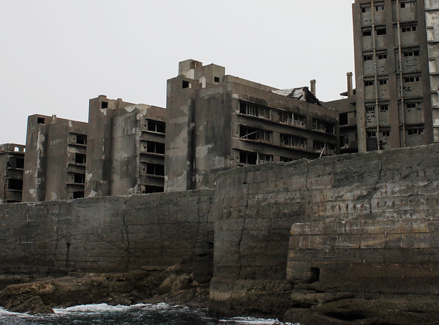
The island was populated from 1887 to 1974 as a coal mining facility. The island’s most notable features are the abandoned and undisturbed concrete apartment buildings and the surrounding sea wall.
The funny thing is that Google Maps has STREET VIEW of the entire island.
The funny thing is that Google Maps has STREET VIEW of the entire island.
It is known for its coal mines and their operation during the industrialization of Japan. Mitsubishi bought the island in 1890 and began the project, the aim of which was extracting coal from undersea mines. They built Japan’s first large concrete building (9 stories high),[1] a block of apartments in 1916 to accommodate their burgeoning ranks of workers. Concrete was specifically used to protect against typhoon destruction. In 1959, the 6.3-hectare (16-acre) island’s population reached its peak of 5,259, with a population density of 835 people per hectare (83,500 people/km2, 216,264 people per square mile) for the whole island, or 1,391 per hectare (139,100 people/km2) for the residential district.
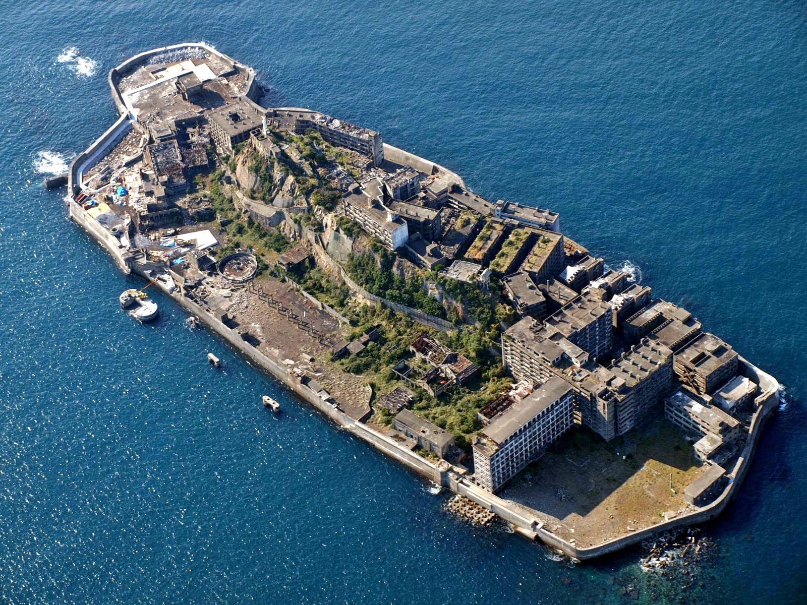


As petroleum replaced coal in Japan in the 1960s, coal mines began shutting down all over the country, and Hashima’s mines were no exception. Mitsubishi officially announced the closing of the mine in 1974, and today it is empty and bare, which is why it is called Ghost Island. Travel to Hashima was re-opened on April 22, 2009 after 35 years of closure.


Read also our article about Chernobyl
info: Wikipedia
pictures: Flickr
street view: Google Maps
Something's wrong with this post?
Missing Images? Broken links?
Help Us. Report it!
Missing Images? Broken links?
Help Us. Report it!